




Professional drone · Guinea
Drone Guinea — topography, LiDAR and mining volumetrics from Conakry
OHM WORKS has an agency in Conakry and operates across Guinea: bauxite and iron-ore stockpile volumetrics, topographic surveys of mine sites and infrastructure, airborne LiDAR under forest canopy, power line and tower inspection. Same production chain as our Cotonou headquarters, same accuracy guarantees.
- Volumetric tolerance
- ± 1 %
- XY · Z accuracy
- < 3 cm · < 5 cm
- Firm quote
- 48 h
Why Guinea
A market where geospatial data has direct value
Guinea is the world's largest bauxite exporter and, with Simandou, holds one of the largest untapped iron-ore deposits on the planet. Every tonne stockpiled, every cubic metre extracted, every kilometre of railway or power line is measured, checked and planned. That is exactly what a drone engineering studio delivers.
Bauxite · Boké, Kamsar, Sangarédi, Fria
Stockpile inventories on mine pads and mineral ports, extraction-front progress monitoring, geometric control of haul roads and settling ponds. Volumetric tolerance ± 1 %, defensible in financial audits.
Iron and gold · Simandou, Nimba, Siguiri
Pre-mining topographic surveys, LiDAR digital terrain models under forest cover, earthworks and linear infrastructure monitoring (railway, access roads, conveyors). Georeferenced data ready for design offices and EPCM contractors.
Energy, agro-industry, Conakry
LiDAR and thermal inspection of HV lines from the Souapiti and Kaléta dams, mapping of plantations and agricultural schemes, monitoring of urban and port construction sites across Greater Conakry.
Our services in Guinea
What we deliver on site
Stockpile volumetrics
Volume measurement of bauxite, ore, waste rock and aggregates by GCP-RTK photogrammetry or LiDAR. Dated volumetric report, 3D mesh, campaign-to-campaign comparison.
Centimetre-grade topography
Orthophotos at 2 cm/pixel GSD, DTM, DSM, contour lines and profiles. GeoTIFF, DXF and SHP deliverables in your site's coordinate system.
Airborne LiDAR
200 to 600 points/m², canopy penetration for deposits and corridors in Guinea's forested zones. Classified LAS/LAZ point cloud.
HSE and geometric compliance
Control of bench slopes, berms and pond embankments. Illustrated report for internal and regulatory audits.
Infrastructure inspection
Power lines, telecom towers, conveyors, port structures. No service interruption, no work at height.
Digital twins and GIS
Textured 3D models, integration into QGIS, ArcGIS Pro, AutoCAD, Vulcan or Surpac. Data your teams can use immediately.
Operating framework
Aviation regulation and geodetic reference in Guinea
- Every professional drone flight in Guinea requires prior authorisation from AGAC (Autorité Guinéenne de l'Aviation Civile). OHM WORKS prepares and files the permit application for each site.
- Mine sites under concession additionally require the operator's consent and coordination with its HSE department: flight plan, exclusion zones, blasting schedules.
- Restricted zones around Conakry's Ahmed Sékou Touré international airport and mining airstrips (Kamsar, Sangarédi): feasibility check before any quote.
- SORA risk assessment and drone liability insurance on every mission, as in Benin and France.
Delivery reference system
- Guinea straddles two UTM zones: 28N (Conakry, Boké, Kindia) and 29N (Kankan, Siguiri, N'Zérékoré). We deliver in the site's zone on WGS84 (EPSG:32628 / EPSG:32629).
- Tie-in to historical concession datums (Dabola 1981, Conakry 1905) or the mine's local grid is possible when control points are supplied.
- Accuracy check on independent verification points, recorded in every delivery report.
Comparable references
Equivalent missions already delivered in West Africa
Our Guinean case studies will be published with the operators' consent. Meanwhile, here are three missions delivered in Benin with the same sensors, protocols and deliverables we deploy in Guinea.
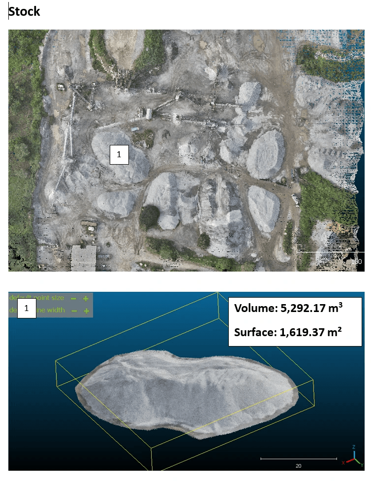
Stockpile inventory of a BCG quarry
Drone mission for BCG (Bénin Carrière Granulat): orthophoto, DTM/DSM, high-resolution point cloud, stockpile inventory and geometric conformity check of operating slopes.
See the case study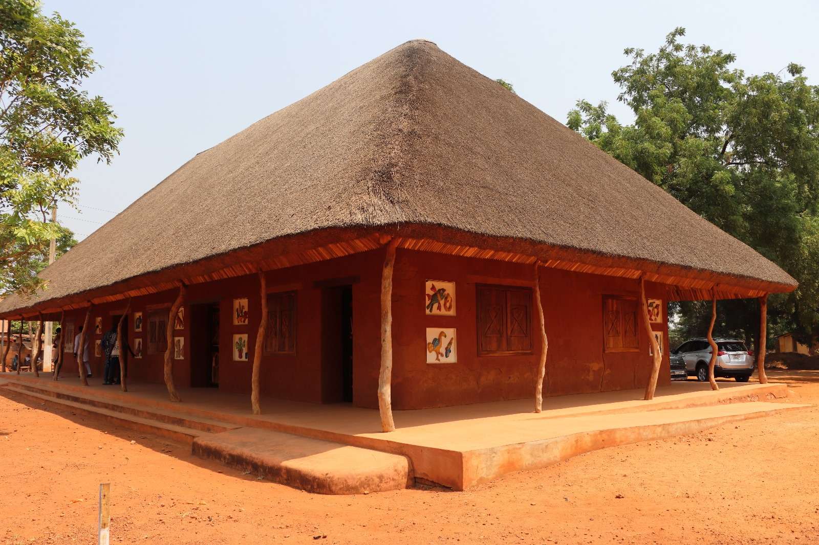
100 ha LiDAR survey of the Royal Palaces of Abomey
Complete airborne LiDAR survey of a UNESCO World Heritage site for the ANPT. Orthophoto, DTM/DSM, point cloud and full geometric extractions: road footprints, buildings, roofs, perimeter walls and miscellaneous structures.
See the case study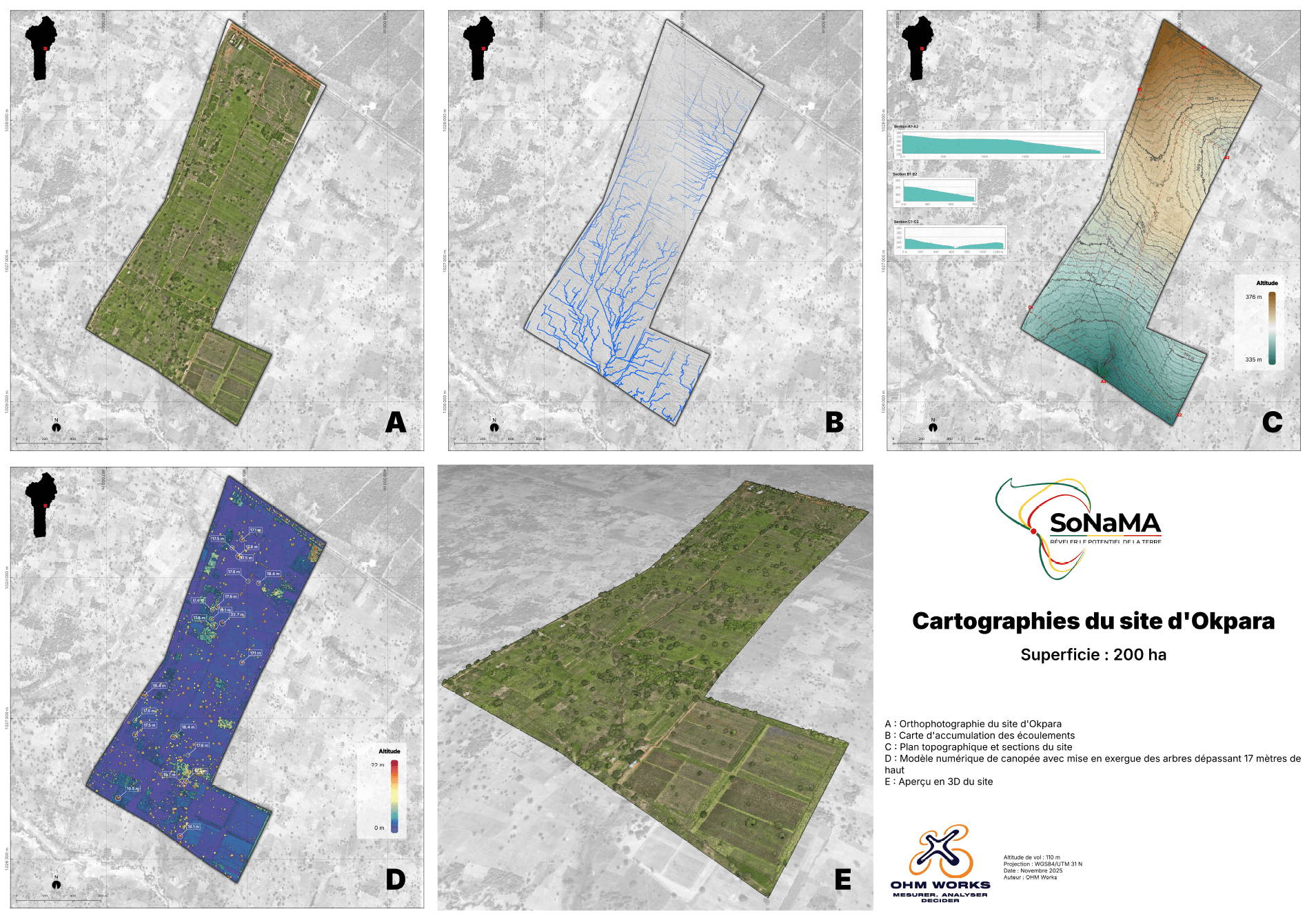
200 ha LiDAR survey of the Okpara Farm
LiDAR mapping of a large-scale integrated agricultural zone for SoNaMA. Orthophoto, DTM/DSM, point cloud and tree detection. Multi-layer restitution for agricultural planning and canopy monitoring.
See the case study
Conakry agency
Local presence, a single production chain
The Conakry agency handles client relations, regulatory preparation and field coordination with our network of Guinean drone pilots. Photogrammetric and LiDAR processing is carried out by the OHM WORKS engineering studio, with the same quality controls as for our Beninese and French clients. One point of contact from brief to delivery.
Locations
- Agency — Conakry, Guinea
- Operations base — Fiyègnon Jacquot, Cotonou, Benin
Frequently asked
Drones in Guinea — what clients ask
Does OHM WORKS really operate in Guinea?
Yes. OHM WORKS has an agency in Conakry that handles client relations, AGAC permit applications and flight coordination with local pilots. Data processing is carried out by our engineering studio, which already produces deliverables for our clients in Benin and France.
What permits are needed for a drone flight in Guinea?
Prior authorisation from AGAC (Guinea's civil aviation authority) is required for every professional flight. On a mine site, the operator's consent and HSE coordination are added. OHM WORKS prepares the full file; allow two to four weeks of administrative lead time depending on the area.
What accuracy for a bauxite stockpile volumetric survey?
On a photogrammetric protocol with RTK GPS ground control points, measured volumetric tolerance is ± 1 %. Planimetric accuracy is below 3 cm and vertical accuracy below 5 cm. Every volumetric report states the method, point-cloud density and check points used.
Which coordinate system do you deliver in Guinea?
By default WGS84 / UTM zone 28N or 29N depending on the site location. We can also deliver in the mine's local grid or in a historical concession datum, provided known tie-in points are available.
How long does a mission on a Guinean mine site take?
Allow two to four weeks between order and flight to obtain the AGAC permit and the operator's consent. On site, a mine-pad stockpile survey is flown in one to two days. Deliverables are sent five to ten business days after the flight.
Also looking for coverage in Benin? See our city pages.