




Gallery
Raw data becomes maps. Maps become decisions.
Every map in this gallery is interactive and built on public data — satellites, weather models, alert systems — continuously reloaded. The same processing chain applies to your own data: sites, works, networks, plantations.
 Live
LiveForestry · Agribusiness · Insurance
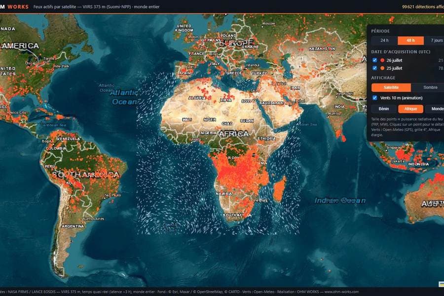
Active fires from space
Every dot is a fire detected by the VIIRS 375 m sensor over the last 48 hours, worldwide, reloaded on every visit.
Explore the map
 Live
LiveDrone operations
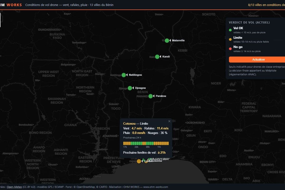
Live drone flight weather
Wind, gusts and rain across 13 Beninese cities, turned into an operational verdict: Fly, Marginal or No-go, with the next 24 h windows.
Explore the map
 Live
LiveHumanitarian · Insurance
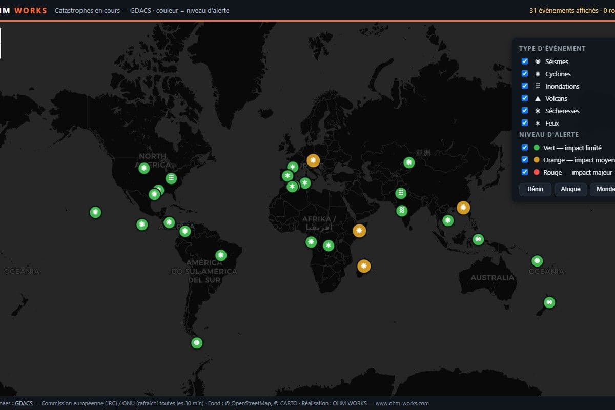
Global disaster alerts
Ongoing earthquakes, cyclones, floods, volcanoes and droughts, ranked by GDACS alert level and exposed population. Refreshed every 30 minutes.
Explore the map
 GIS analysis
Agriculture · Forestry
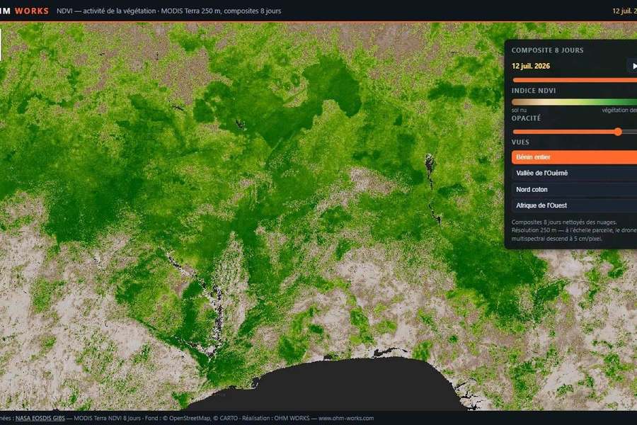
Vegetation, month by month
The MODIS NDVI index over a rolling 12 months: dry season, rainy season, water stress — a time slider to watch Benin breathe.
Explore the map
 GIS analysis
Urban planning · Land management
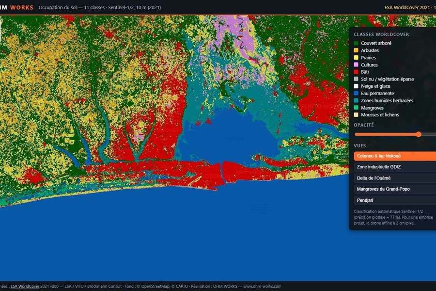
Every hectare, classified
ESA WorldCover at 10 m resolution: tree cover, cropland, built-up, wetlands, mangroves — all 11 land cover classes across Benin.
Explore the map
 GIS analysis
Forestry · Carbon
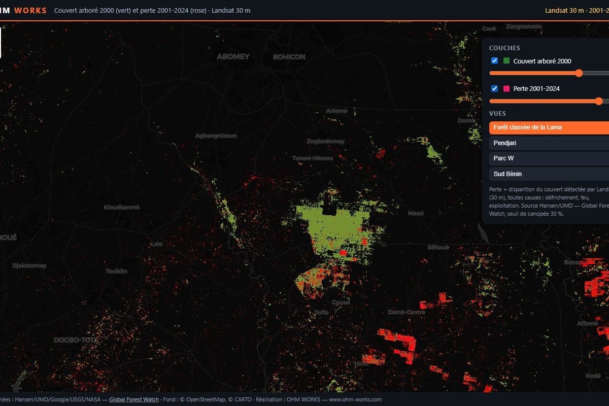
Twenty years of forest loss
Tree cover from 2000 in green, every pixel lost since in pink: Hansen/UMD data at 30 m over Lama, Pendjari and W parks.
Explore the map
 GIS analysis
Urban planning · Insurance
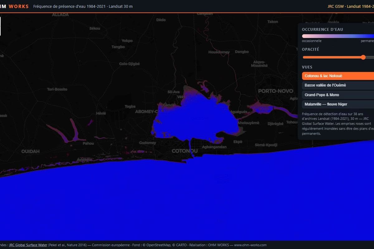
Where water always returns
38 years of Landsat archives in one map: water occurrence frequency around Lake Nokoué, the lower Ouémé valley and the Mono.
Explore the map
 Live
LiveSpace · Remote sensing
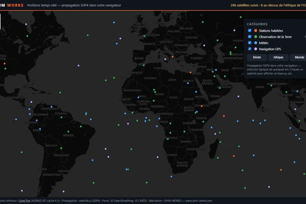
Satellites, live
Nearly 300 satellites — crewed stations, Earth observation, weather, GPS — propagated in real time in your browser. Click one to see its track.
Explore the map
 GIS analysis
Planning · Networks
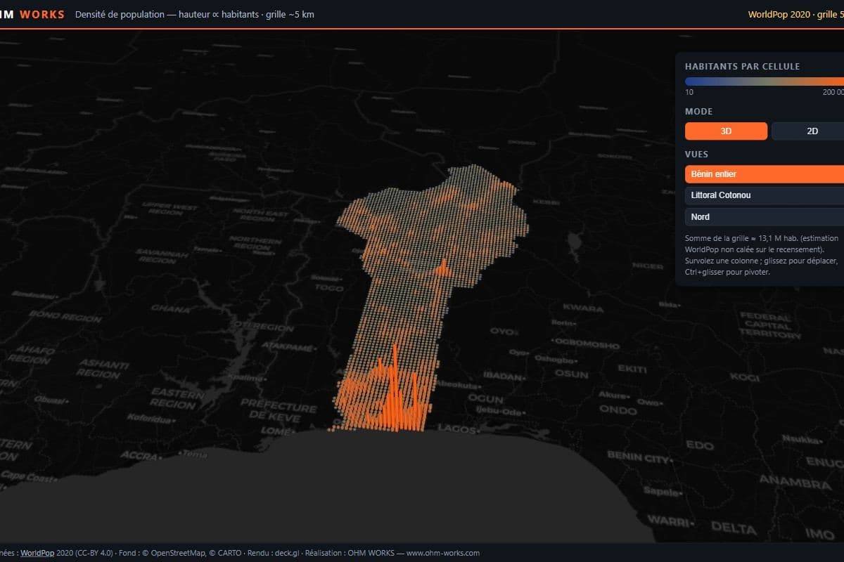
Twelve million people, in relief
Benin's population extruded in 3D on a 5 km grid: the coastal metropolis leaps out, northern corridors and valleys take shape. Rotate, tilt, hover.
Explore the map
What about your data?
Orthophotos, LiDAR point clouds, vigour maps, monitoring dashboards: we build the same kind of decision tool from your sites and your stakes.