


Drone Abomey · Bénin
Drone Abomey — LiDAR, photogrammetry and UNESCO heritage
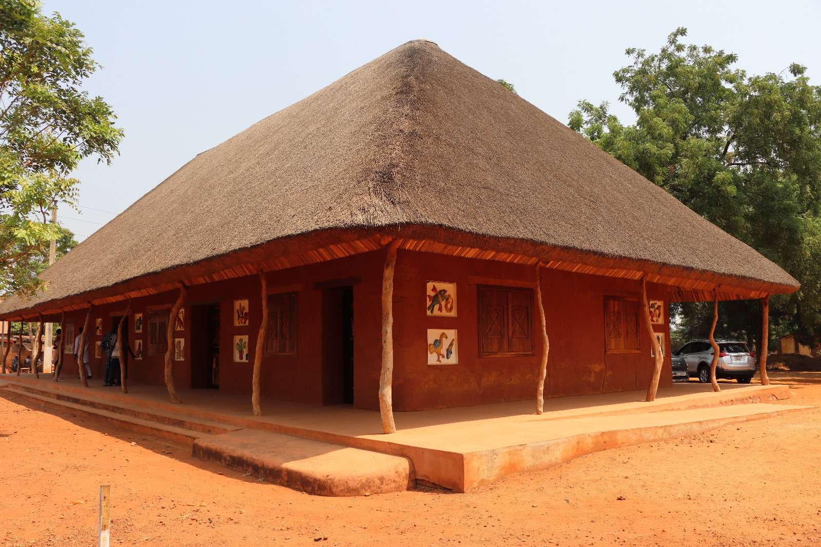
OHM WORKS delivered the full LiDAR survey of the Royal Palaces of Abomey for ANPT — 100 hectares of UNESCO World Heritage site. Our heritage expertise is mobilisable across Zou department for high-precision surveys, 3D modelling and archaeological analysis.
- Coverage
- 60 km
- Quote turnaround
- 48 h
- XY accuracy
- < 3 cm
- Case studies
- 1
Why local
The only drone bureau to have LiDAR-surveyed the UNESCO site of Abomey.
Authorisations for protected sites
The Royal Palaces perimeter is a protected zone. We coordinate upstream with ANPT, ANAC and the Heritage Directorate to secure the necessary flight derogations.
Method adapted to ancient buildings
Earthen walls, fragile roofs, bas-reliefs: our flight parameters and sensors are calibrated to minimise any impact on the historic fabric while guaranteeing resolution.
Mobilisation from Cotonou within 24–48 h
Abomey is 1h30 by road from our base. For ad hoc missions (restoration monitoring, post-event inspection), we mobilise quickly with equipment transported in a secured vehicle.
Documented UNESCO reference
100 hectares LiDAR-surveyed, DTM/DSM produced, centimetric orthophoto, per-building geometric extractions. This reference now feeds conservation planning and archaeological studies.
Available services
Our drone missions in Abomey
In Abomey, demand centres on heritage, urban planning of the regional capital, and forest-land mapping. Our three most-mobilised disciplines locally:
On the ground
Our case studies in Abomey
Our flagship reference: the full LiDAR survey of the UNESCO Royal Palaces site for ANPT — 100 hectares mapped in high-density mode, with DTM, DSM, orthophoto and per-building geometric extractions delivered.
Coverage of Abomey and Zou department
Direct mobilisation from Cotonou (1h30 by road). For multi-day missions, we set up temporary on-site accommodation in Abomey or Bohicon. Our radius covers the entire Zou department (Bohicon, Covè, Za-Kpota, Zogbodomey).
- Service radius
- 60 km
- On-site mobilisation
- ≤ 72 h
Drone regulation in Abomey
The Royal Palaces site is protected by both the Beninese State and UNESCO. Any drone mission within that perimeter requires prior authorisations (ANPT, Heritage Directorate, ANAC). We handle the full administrative process.
- ANAC Benin — Flight declaration and restricted-zone protocol specific to the UNESCO site.
- Protected site — ANPT derogation and upstream coordination with the Heritage Directorate.
- Heritage compliance — Flight parameters calibrated to respect the integrity of the historic fabric.
Frequently asked questions — local
Drone in Abomey — your questions
Are you authorised to fly on the UNESCO Royal Palaces site?
Yes. We delivered the full 100-hectare LiDAR survey for ANPT in 2025. Authorisations are renewable for monitoring or extension missions. For any new commissioning party, we support the administrative request process.
What technology do you use for heritage surveys in Abomey?
High-density airborne LiDAR (up to 800 pts/m²) for buildings and vegetation, multi-view photogrammetry for façades and bas-reliefs. We combine both techniques to produce digital twins usable both in conservation and restoration.
What accuracy do you reach on a heritage building in Abomey?
XY < 3 cm orthophoto accuracy, Z < 5 cm on DTM, 3D mesh resolution ≤ 2 cm per side. Sufficient for pathology analysis, building volumetrics and crack monitoring.
Do you work with archaeologists and heritage conservators?
Yes. Our deliverables (DTM, high-resolution orthophoto, 3D model) are designed to integrate with scientific teams' GIS tools (QGIS, ArcGIS Pro). We coordinate upstream with researchers to calibrate resolution against the expected scientific use.
How much does a heritage drone survey cost in Abomey?
Pricing depends on surface area, required LiDAR density and authorisation complexity. For a sub-hectare site, expect to start at around 800,000 CFA. For a Royal Palaces-scale site (100 ha), a detailed quote is established based on expected deliverables.
A project in Abomey?
Firm quote within 48 h, team based in Cotonou.
Photogrammetry, LiDAR, thermography, 3D modelling — XY accuracy < 3 cm on every deliverable.