Skip to content
OHM WORKS MEASURE · ANALYZE · DECIDE
Aqueduc de Castries (Hérault) — relevé photogrammétrique par drone OHM WORKS
← All industries

Industry

Urban Planning & Construction

From sketch design to project handover, OHM WORKS supports public clients, design offices and construction firms with high-precision drone services. Our acquisition and processing protocols deliver data that can be used immediately by design, site and quality control teams.

Applications

  • High-precision topographic surveys

    Orthophotos at 2 cm/pixel, DTM/DSM and cadastral plans usable from the very first design phases.

  • Continuous site monitoring

    Periodic photogrammetric captures, inter-phase comparison, alerts on deviations from the plan.

  • Volumetrics within ± 1 %

    Earthwork volumes, cut/fill and stockpiles computed within tolerances accepted in public contracts.

  • 3D modeling and BIM

    IFC, OBJ and GLB models that integrate into Revit, AutoCAD Civil 3D and ArchiCAD for design and operations.

  • At-height inspection without lifts

    Façade, roof and infrastructure inspection in safety, without service interruption, with HSE-compliant reports.

  • Urban risk mapping

    High-resolution DTM for flood-risk studies, coastal erosion and climate resilience of urban developments.

Areas of expertise

From regional planning to heritage buildings

Suivi photogrammétrique aérien d'un chantier en cours

Construction & sites

From design to handover, without precision drift

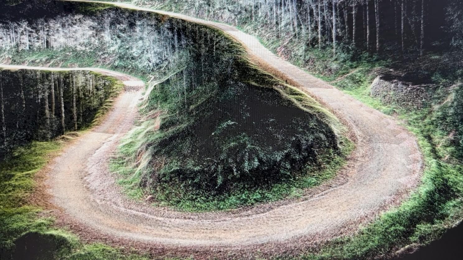
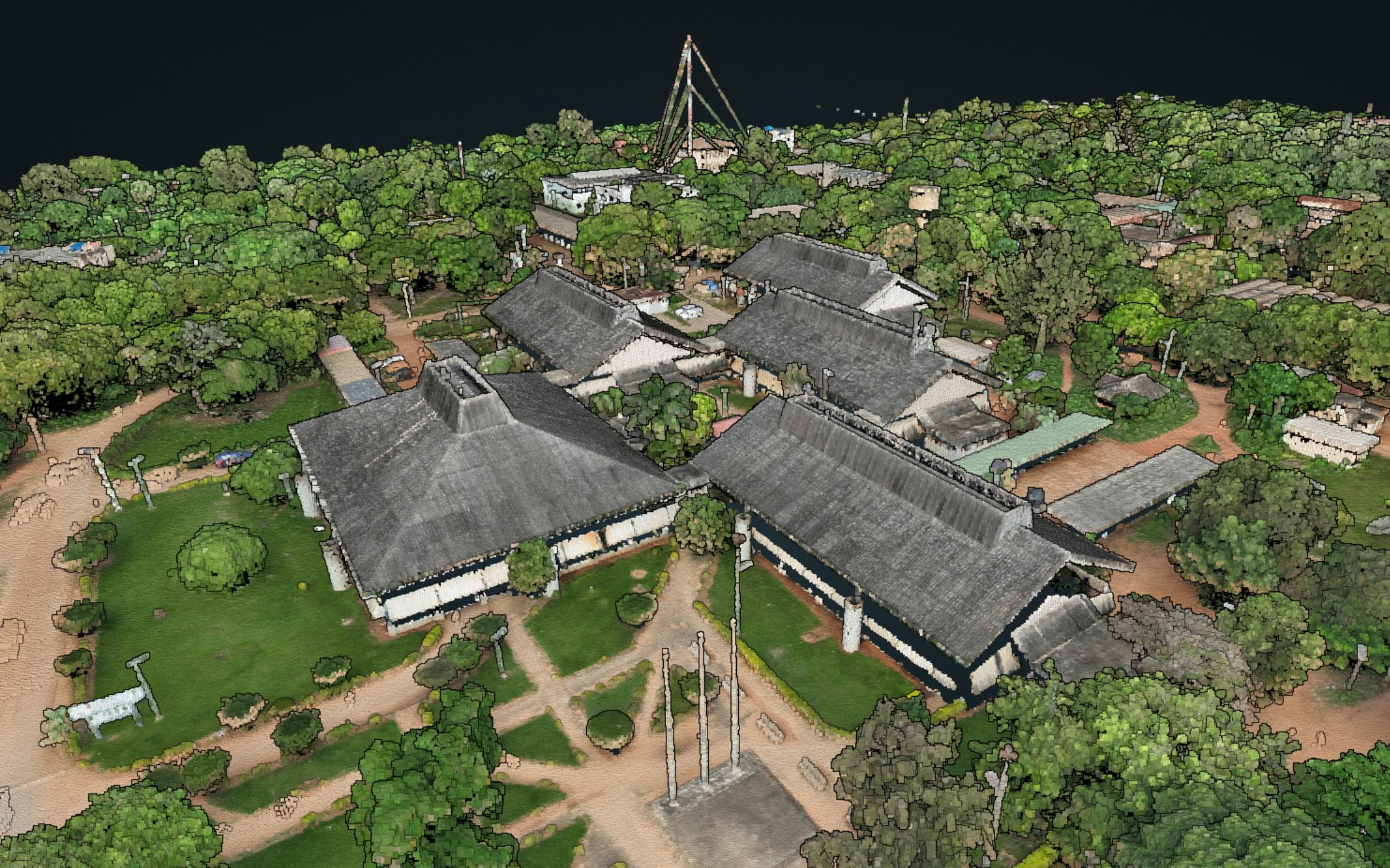
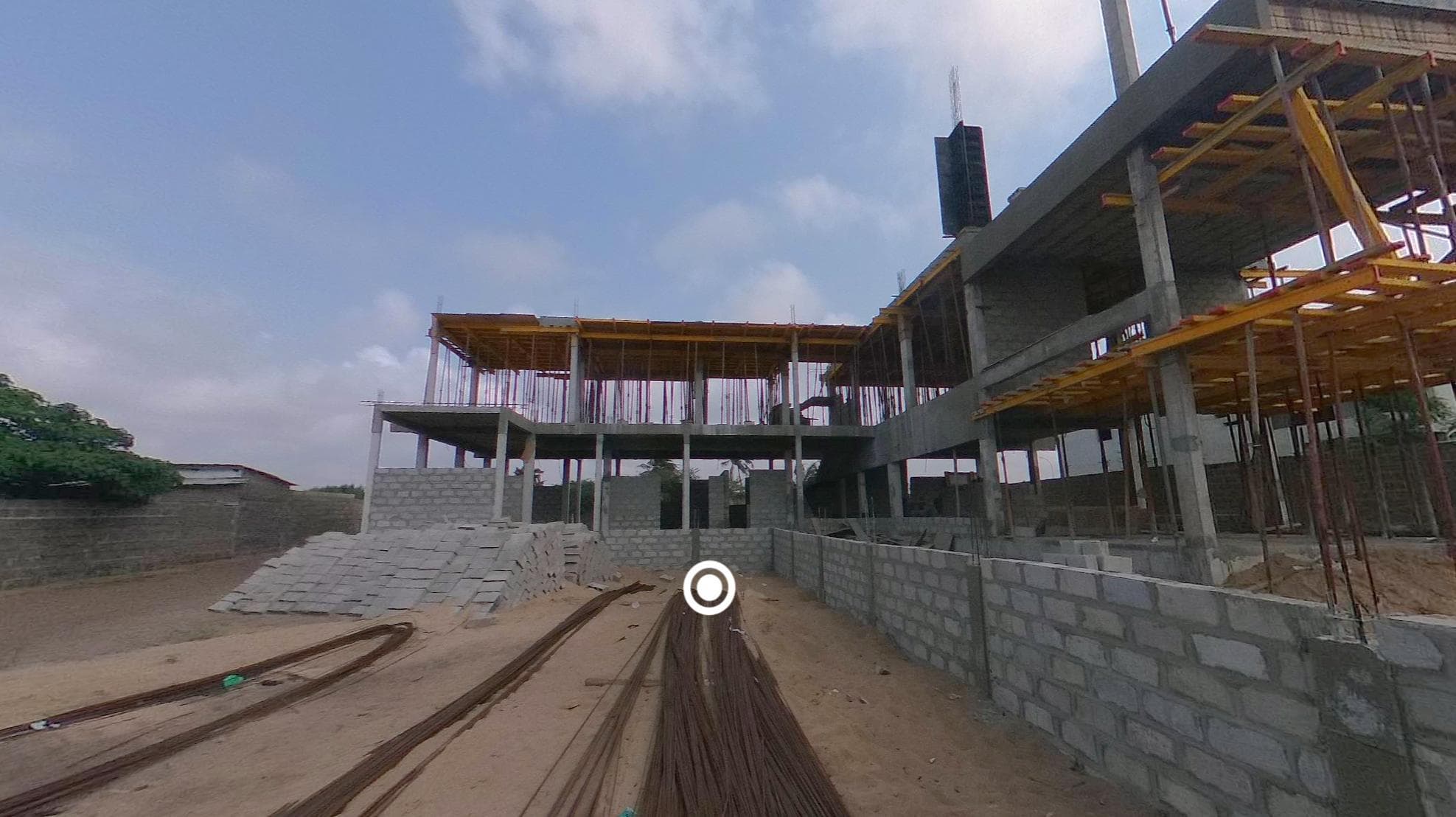
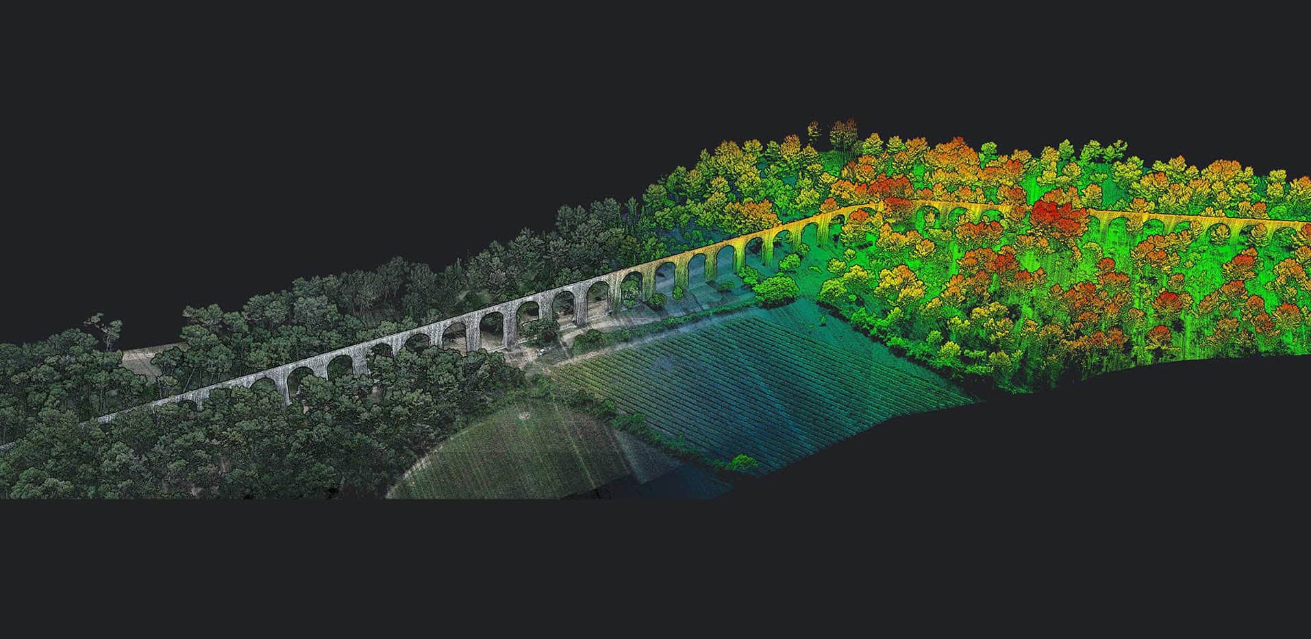
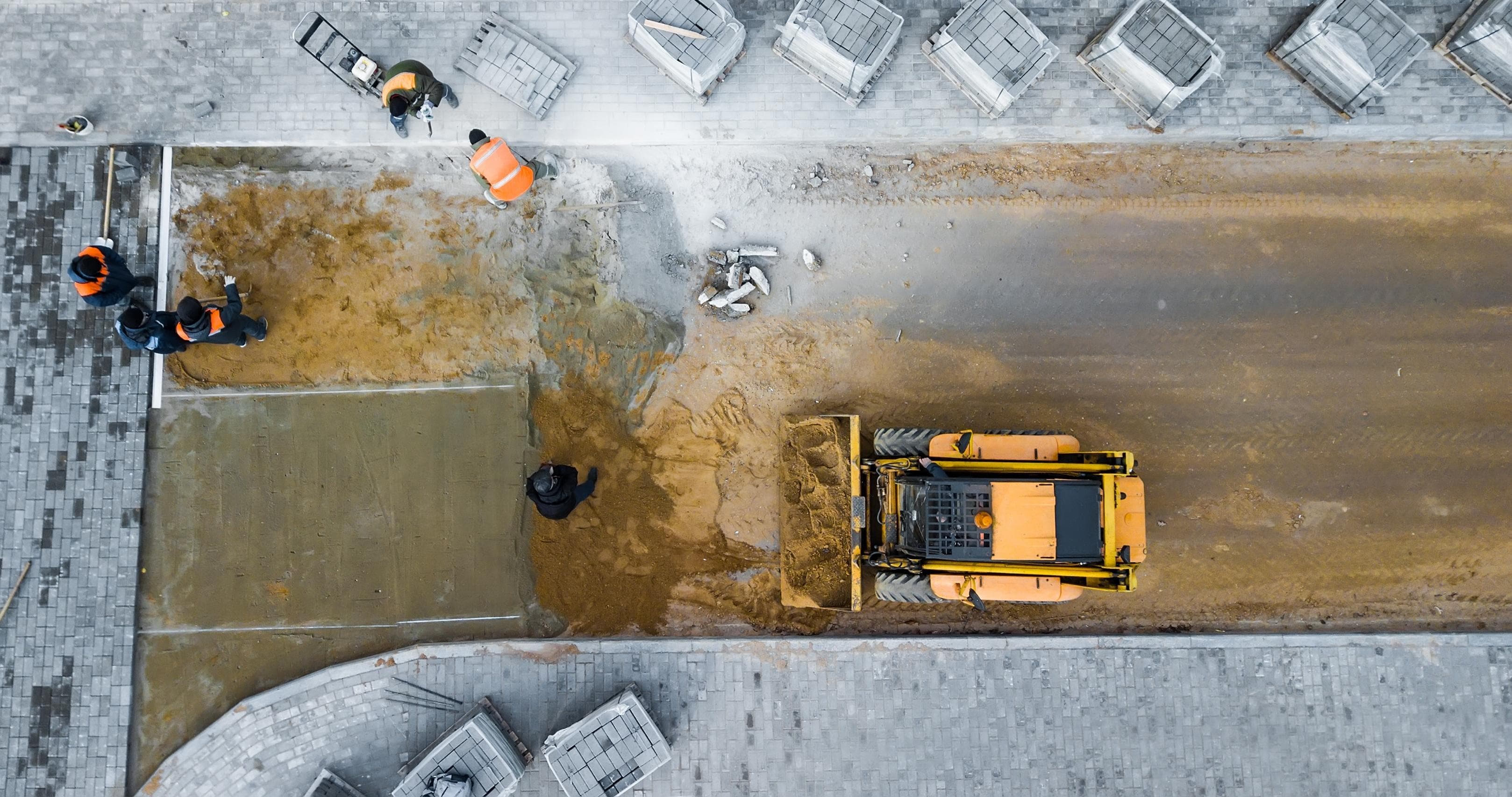
Full control over your construction sites through high-precision aerial topographic surveys. From the design phase to project handover, our photogrammetry and LiDAR protocols deliver data that is immediately usable by design, site and control teams.

  • LiDAR topographic surveys with DTM usable even under tree cover
  • Periodic georeferenced site monitoring, with phase-deviation detection
  • Stockpile and earthwork volumes within ± 1 % tolerance, compliant with public contracts
MNT haute précision d'une route sous couvert végétal — détection LiDAR

Road infrastructure

Anticipate topography under vegetation cover

No need to wait for clearing to precisely understand topography. Our high-precision Digital Terrain Model penetrates vegetation and ensures reliable analysis of longitudinal and cross profiles and cut/fill volumes. Early detection of instabilities, subsidence, erosion and drainage defects significantly reduces corrective maintenance costs.

  • Centimetric DTM with no prior clearing, even under wooded routes
  • Automatic extraction of longitudinal and cross profiles and volumetrics
  • Automated land studies along long linear corridors
Jumeau numérique 3D des Palais Royaux d'Abomey, site classé UNESCO

Point cloud · University of Abomey-Calavi · Benin

Buildings & public facilities

3D digital twins for study and refurbishment

LiDAR enables extremely accurate 3D digital twins, supporting structural studies, refurbishment projects and extension planning. Detailed analysis of deformations, subsidence and structural pathologies anticipates risks and prioritizes work objectively. Full capture of façades, roofs and surrounding volumes optimizes heritage management and reduces costs tied to traditional at-height surveys.

  • 3D digital twins for structural studies and extension planning
  • Documented analysis of deformations, subsidence and pathologies
  • Full façade, roof and volume capture — no lift required

Our method

A proven three-step protocol, from technical brief to delivery of usable data.

  1. 01Step 1

    Technical brief & quote

    Scope alignment with your design office: perimeter, deliverables, ANAC constraints (zone, NOTAM, SORA risk analysis if needed), target accuracies. Firm quote within 48 hours.

  2. 02Step 2

    Certified field acquisition

    Drone flight by DGAC / ANAC-certified pilot, RTK GNSS and georeferenced GCP targets, minimum 80/70 overlap. Capture over 1 to 3 days depending on area.

  3. 03Step 3

    Processing and delivery

    Photogrammetry via Agisoft Metashape or Pix4D, DTM/DSM generation, orthophotos and textured 3D model, delivery in EPSG:32631 (UTM 31N) or Lambert 93 by zone.

Virtual tours

Monitor your sites remotely, in 360° photo

Our 360° virtual tours, hosted on a secure web platform, allow project owners and quality controllers to track progress without frequent on-site visits. Dated and geolocated visual traceability, ideal for comparing execution phases and securing contractual exchanges.

  • Dated, geolocated traceability

    Compare execution phases, document reservations, secure contracts and final accounts.

  • Remote monitoring without travel

    Cut logistics costs and speed up decisions between project owner, lead designer and contractors.

  • Simple link-based access

    Tour your site with a single shared link — desktop or mobile, no installation required.

Visite virtuelle 360° d'un chantier de bâtiment au Bénin

FAQ · Frequently asked

The questions we hear most often.

What accuracy can I expect from a drone topographic survey?

With a rigorous GCP-RTK protocol, we reach < 3 cm planimetric XY and < 5 cm altimetric Z. This accuracy is sufficient for AVP, PRO and DCE phases, and directly usable by construction design offices without an additional ground survey.

Does drone replace the traditional surveyor?

No, it complements them. Land surveyors remain essential for boundary marking, parcel division and administrative deeds. The drone supplements them on large-scale surveys, initial site states and progress monitoring, where it brings an exhaustiveness impossible on foot.

How long to deliver a centimetric DTM on a 5-hectare construction site?

For an open site: half a day of flight and 2 to 3 days of processing. The complete report (orthophoto, DTM, DSM, cross-section plans, volumetric calculations) is delivered 3 to 5 days after field acquisition.

Do you have authorisation to fly in urban areas in Benin?

Yes. Our pilots are authorised by ANAC Bénin and certified DGAC France. We handle prior declarations, NOTAMs and SORA analyses for flights in regulated zones (airport proximity, densely populated areas).

What deliverable formats integrate with Revit or AutoCAD?

Point cloud LAS/LAZ for direct integration, 3D mesh OBJ/FBX for modelling, georeferenced GeoTIFF orthophoto, DTM as GeoTIFF, and IFC formats on request. Default coordinate system is UTM Zone 31N (EPSG:32631) but we adapt to client datums.